
We have been exploring how a hyper-local approach can unlock new solutions to digital exclusion in the over 60s. For our latest piece, Data & Evaluation Analyst, Gabriela Mihaylova examines the intersection of digital and real worlds in our DSIT-funded research. As we try to anticipate the impact of emerging technologies on the lives of some of the most vulnerable, what might we learn from the past and ‘garden city’ principles?
The digital world is key to many aspects of urban life and to the behaviours and experiences of those living in cities. But can we also look to the past and link emerging tech to historical ideas about the city and the way people live in it?
Some might be familiar with Ebenezer Howard, a socialist urban planner from the 19th century who developed many innovative ideas around an inclusive agenda that aimed to enable the best possible balance between the city and its citizens. His idea for the ‘garden city’ stemmed from a desire for social order and inclusiveness, putting human wellbeing at the centre of the model. It relied on principles of being close to nature, of sustainability, of vibrant culture and connected communities.
While the concepts that define the garden city were not related to today’s digital world, Howard’s ambition of balance between the city and its citizens can be closely applied to our work at DG Cities. When we think about digital exclusion, it is always through a people-centred lens and using people-based data (age, income, education), but as we’ve come to realise, we have missed out on making fuller use of city/neighbourhood data. Supported by the government's Digital Inclusion Innovation Fund, we trialled a novel approach to understand the systemic factors that result in digital exclusion by using behavioural systems mapping in five distinct neighbourhoods - an exercise based on Howard’s model of people, place and connection.
Digital exclusion as a barrier to everyday life
We believe that to understand digital exclusion, we need to first understand where and why it happens, If we're to create meaningful interventions that maintain a balance between digital and physical realms. This matters because today, being digitally excluded doesn’t just mean refusing to be on social media, or choosing to meet up in person instead of video calls, or even reading a newspaper instead of the online news. It means something much more all-embracing.
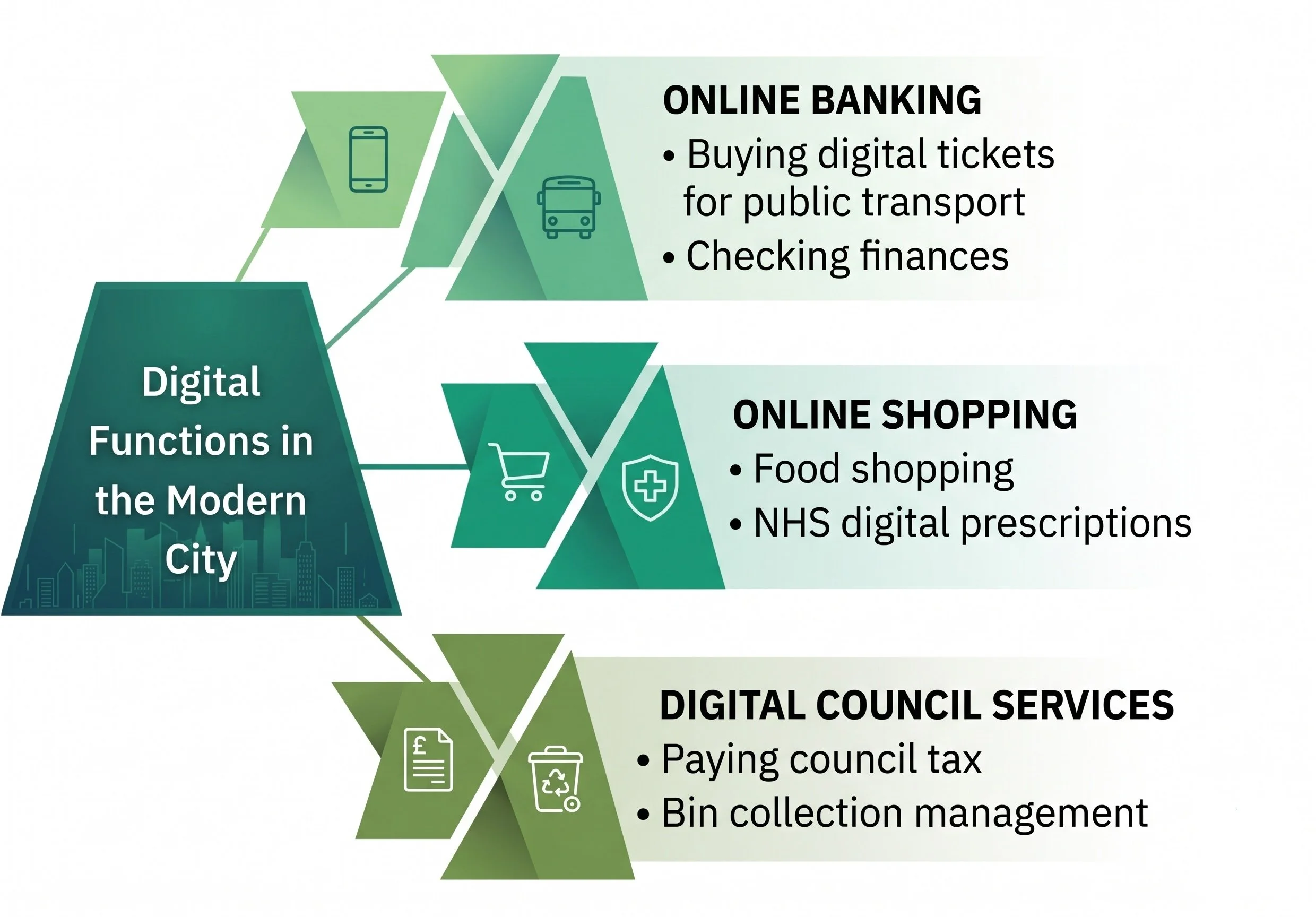
Every aspect of our lives is becoming digital: 'smart city' advances have seen digital services make use of urban sensors, live monitoring of pollution and public transport updates, local authorities changing their communication methods to make efficiencies, national systems and services increasingly minimising in-person options for common tasks...
Exclusion from this can be single layered, with a clear cause, such as social exclusion, geographical exclusion, digital exclusion. Or, it could involve multiple factors occurring in the same area and/or at overlapping times. Regardless of its type, we understand exclusion as when an individual is ‘outside’ of a system, structure, or community and at DG Cities, we strive to identify interventions that really benefit people.
As the different types of innovation often intertwine, we tested a new approach to understanding digital exclusion, as we believe that it can overlap with social and geographical exclusion. Therefore, looking at all three allowed us to understand:
a) how and why does digital exclusion happen,
b) who is affected,
c) what are the shorter- and longer-term impacts of digital exclusion,
d) what might exacerbate it and how might we prevent/mitigate it.
Our approach used open-source data, GIS software and national area classifications and acted as a complimentary lens to our principal approach Behavioural System Mapping. Combining the two approaches does not just tell us who is excluded, but also reveals how their immediate neighbourhood further contributes.
Taking Horn Park, a neighbourhood we worked with in the Royal Borough of Greenwich, as an example…
Working with local stakeholders, and utilising our mapping approach, we learnt that two community assets, which were less connected on our behavioural systems map, were in-fact located outside the estate. Their distance mattered. While they are within walking distance of parts of the estate and reachable by bus, many residents perceive their location as a challenge, particularly those with limited mobility, and feel that they are ‘not for them’ and serve other neighbourhoods. One of the proposed interventions for this area was to open a community-based informal digital support hub.
Bringing support to where it’s most needed
The key spatial components here are the location of the venue and access/mobility, as these can significantly impact turnout. This approach may shift current perceptions of some local venues and therefore needs to be tested. In future work, we can give more time and space to the quality of the offer of assets that geographically sit outside the focus area. Similarly, we must design interventions that aim to encourage accessibility to all good venues and remove negative perceptions around who is being served by each.
After all, garden cities were intended to be managed collectively by and for the community. Although we’re not focusing on former garden cities, it’s interesting to reflect on how some of today’s initiatives reflect Howard’s ideas. For example, in Horn Park there is a weekly walk around the estate and its green areas, which could be combined with the opening of a community-based informal digital support hub. These are the kinds of synergies we’re interested in exploring as we take our methodology further.